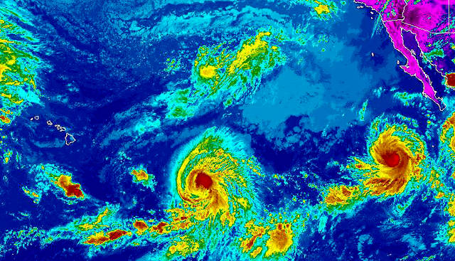
KAILUA-KONA — Forecasters are keeping tabs on a pair of hurricanes spinning in the Eastern Pacific far east-southeast of the Hawaiian Islands.
As of 11 a.m. Wednesday, Hurricane Miriam featured 75 mph winds with higher gusts and was tracking west at 9 mph about 1,090 miles east-southeast of Hilo, according to forecasters at the Miami-based National Hurricane Center.
Miriam is expected to enter the Central Pacific basin, which is where Hawaii is located, this afternoon at which point forecasters with the Honolulu-based Central Pacific Hurricane Center will assume responsibility for monitoring the storm.
Some additional strengthening is possible during the next 24 hours, however, Miriam is expected to begin weakening on Friday as it encounters strong upper-level winds and cooler waters.
By mid-day Sunday, current forecast models have Miriam downgraded to a post-tropical remnant low with 35 mph winds.
Also in the Eastern Pacific is Hurricane Norman, which was located more than 2,500 miles east-southeast of Hilo as of Wednesday morning. Norman was circulating 60 mph winds with higher gusts as it tracked west-southwest at 9 mph, forecasters said.
Rapid intensification is forecast, and Norman is expected to become a major hurricane on Thursday.
Current forecast models have Norman peaking on Friday as a Category 4 hurricane packing 130 mph winds before it starts to weaken. On Friday, Norman is expected to be about 2,100 miles east-southeast of the Big Island.


